
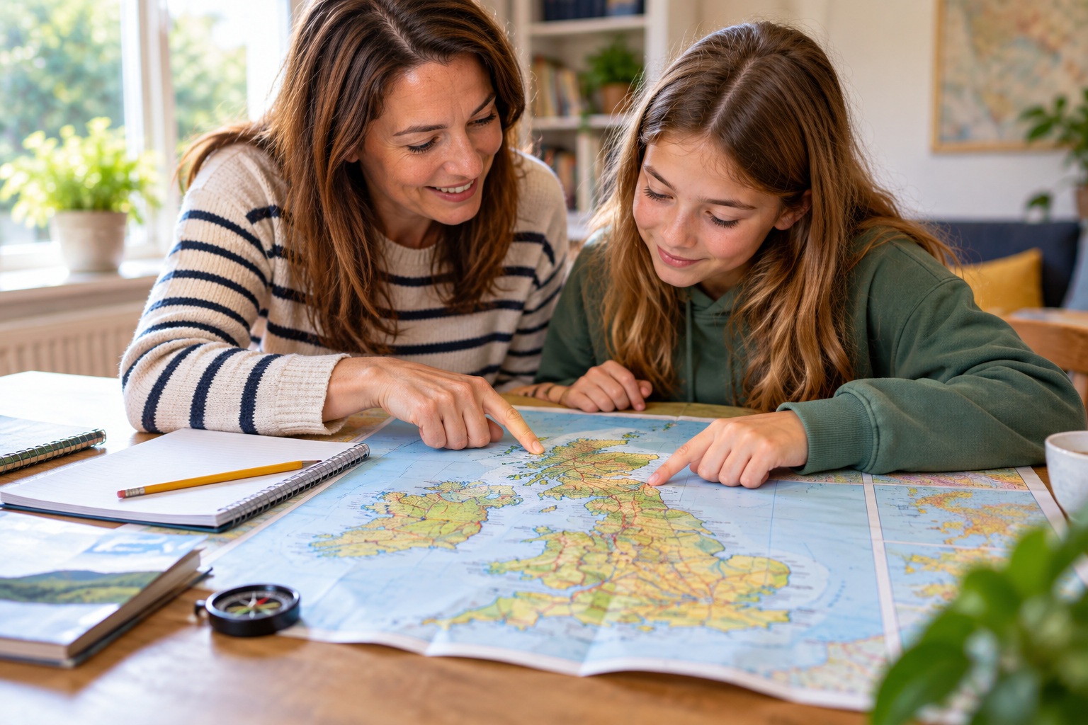
When was the last time you unfolded a paper map before setting off on a journey? For many families, it may have been quite a while. Sat navs, smartphones and navigation apps have transformed the way we get around. We can type in a destination, press start and simply follow a series of instructions telling us where to turn. It is convenient, accurate and, for most of us, now completely normal.
However, something has been lost along the way. Reading a map used to be an everyday skill. Children might have watched their parents unfold a road atlas in the car, followed a paper map on a family walk or helped work out the route to a holiday destination. Today, many children can travel considerable distances without ever needing to work out where they actually are or how one place connects to another.
That doesn’t mean we need to abandon digital maps and return to keeping an enormous road atlas in the glovebox. Digital maps can be excellent learning tools too. The important difference is between actively reading a map and simply following turn-by-turn instructions.
Whether it is a paper map spread across the kitchen table or a digital map explored on a phone or tablet, maps give children opportunities to interpret information, recognise symbols, make connections, follow sequences and solve problems. In other words, map reading is a surprisingly effective way to develop comprehension skills.
What does map reading have to do with comprehension?
When we think about reading comprehension, we tend to think about books, stories and passages followed by questions. However, comprehension is really about making meaning from information, and that information doesn’t always have to be presented as a block of written text.
Imagine giving your child a map of a country park and asking them to work out how to get from the car park to the playground. They need to find the car park, locate the playground and look at the paths connecting them. They might need to use a key, recognise landmarks, compare different routes and decide which direction to travel.
They are locating relevant information, ignoring information they don’t need, interpreting symbols, making connections and reaching a conclusion. Those are all comprehension skills, and they are skills children use when making sense of written information at school too.
The disappearing skill of reading a map
There is nothing inherently wrong with sat nav. For busy families, being told exactly where to turn is incredibly useful. Most of us would probably be reluctant to give it up, particularly when driving somewhere unfamiliar.
However, following sat nav instructions requires something quite different from reading a map independently. If a device tells us to turn left in 200 metres, we can follow the instruction without necessarily understanding the wider route. We may have little idea which direction we are travelling, what lies around us or how our current position relates to our destination.
A map asks more of us. A child looking at a map has to establish where they are, where they want to go and what lies between those two points. They may need to anticipate upcoming landmarks, compare possible routes and keep checking their progress.
That active thinking is what makes map reading so useful educationally. It is also why there is value in occasionally giving children a paper map, even when you have a perfectly good digital alternative available.
Paper maps encourage children to see the bigger picture
Paper maps have one particular advantage; they make it easy to see an entire area at once. A road map, walking map or visitor map allows children to see where different places are in relation to one another rather than concentrating only on the next turn.
You could spread a map across the table before a journey and encourage your child to investigate the route. Rather than explaining everything yourself, try asking questions such as:
- Where are we starting?
- Where are we trying to get to?
- Which towns or places will we pass?
- Can you see another route we could take?
- What landmarks might we notice along the way?
- Which direction will we be travelling?
This encourages children to think about the journey as a whole rather than as a sequence of individual instructions.
Paper maps also involve plenty of practical comprehension. Children may need to use a key, understand different coloured roads or paths, recognise symbols and find place names amongst a large amount of other information. There is something wonderfully simple about being able to draw a finger along a route and say, “We’re here, and we’re going there.”
Digital maps can develop these skills too
Paper maps are not the only option. Digital maps can be excellent for developing comprehension, provided children are encouraged to explore them rather than simply watching a navigation arrow.
Before setting off, you could open a digital map together and look at the whole route. Zoom out and ask your child where the destination is in relation to home. Look for towns, roads, rivers or landmarks that they recognise. Then zoom in and see what changes and what new information becomes available.
This can prompt plenty of natural questions:
- Can you find the road we live on?
- Where is the nearest park or railway station?
- What happens to the information when we zoom out?
- Which of these two routes looks shorter?
- Why might the app recommend a different route?
- What landmarks could help us know where we are?
Zooming in and out is itself an interesting comprehension activity because it demonstrates how the amount and type of information available changes depending on perspective.
Children can also compare suggested routes and discuss why one might be quicker despite appearing longer, or why a walking route differs from a driving route. The aim is not to reject technology. It is to encourage children to use it actively rather than passively.
Maps encourage children to look for meaning
Some children can read a passage aloud accurately but struggle when asked what it actually means. This is an important distinction. Decoding words and understanding information are related skills, but they are not the same.
Maps encourage children to actively search for meaning. They need to work out what individual pieces of information represent and then connect them to form a bigger picture.
While looking at a map together, you might ask:
- Where are we now?
- How do you know?
- What does this symbol mean?
- Which path do you think we should take?
- What tells you that?
- How will we know when we are nearly there?
These questions encourage children to explain their thinking rather than simply produce an answer. They also help children understand that good comprehension often involves gathering several pieces of information and putting them together.
Learning to identify important information
Maps can contain a lot of information at once. A town map might show roads, parks, railway stations, schools, rivers, footpaths and landmarks. A visitor map could contain toilets, cafés, entrances, exits, play areas and different attractions.
Children therefore have to decide which information matters for the task in front of them. If you are trying to find the nearest café, the location of every car park probably isn’t particularly important. If you are finding your way back to the car, that information suddenly becomes very relevant.
This is similar to reading comprehension. When children read a passage, they need to distinguish between central ideas and supporting details. They also need to recognise which information is relevant to a particular question rather than becoming distracted by everything else on the page.
Maps provide a practical, real-world way to practise exactly this skill.
Understanding symbols and keys
Paper maps in particular can introduce children to the idea of a map key or legend. A blue line might represent a river, a particular symbol might indicate a railway station and different coloured paths could represent walking or cycling routes.
To understand the map properly, children need to use one source of information to interpret another. They might find an unfamiliar symbol, refer to the key and then return to the map with a new understanding of what they are looking at.
Digital maps use symbols too, although we can become so familiar with them that we barely notice. Ask your child how they can tell the difference between a train station, restaurant, hospital, shop or other location on a digital map.
This reinforces an important comprehension lesson: information doesn’t always come in the form of complete sentences. Colours, icons, labels, lines and symbols can all carry meaning, and children need to learn how to interpret them.
Maps develop inference skills
Not every answer is explicitly stated on a map. Sometimes children need to make an inference based on the information available.
A map might show that one walking route is considerably longer than another, allowing a child to infer that it will probably take more time. An older child using a walking map might recognise that one route involves a steeper climb. On a digital map, they might notice that a geographically shorter driving route is predicted to take longer and begin thinking about possible reasons, such as the types of roads involved or current traffic.
These small deductions require children to combine what they can see with what they already know.
Inference is an important part of traditional reading comprehension too. In stories, children may need to infer how a character feels even when the author doesn’t state it directly. In non-fiction, they may need to draw conclusions by combining different facts. Map reading gives children another context in which to practise this kind of thinking.
Following routes builds sequencing skills
To follow a map successfully, children need to understand that information often has to be processed in a particular order. They might leave the car park, follow the path towards the lake, turn left at the bridge and then continue until they reach the play area.
This develops sequencing skills, which are important across many areas of learning. Children need to understand sequence when following written instructions, recognising the order of events in a story, carrying out a science experiment and completing multi-step maths problems.
You can strengthen this skill by asking your child to explain a route before you begin. Younger children might describe a journey in very simple stages, while older children can give more detailed directions using road names, compass points, distances and landmarks.
Map reading develops vocabulary
Reading maps together also exposes children to useful vocabulary in a meaningful context. Words such as route, direction, distance, landmark, scale, symbol, key, north, south, east and west become much easier to understand when children can use them for a real purpose.
Depending on the map, children might encounter geographical vocabulary such as river, valley, coast, woodland, footpathand boundary. Digital maps can introduce additional language including location, destination, traffic, satellite view and alternative route.
Rather than asking children to memorise definitions in isolation, map reading allows them to see what these words actually mean in practice. This matters because vocabulary knowledge and comprehension are closely connected. The more language children understand, the better equipped they are to make sense of increasingly complex information.
Asking children to explain their reasoning
One of the simplest ways to turn map reading into a stronger learning activity is to ask your child how they know something.
If they tell you which way to go, you could ask what on the map helped them decide. If they identify a building, ask how they knew it was the visitor centre. If they choose between two routes, ask why they think one makes more sense than the other.
There doesn’t always need to be one correct answer. The aim is to encourage children to refer back to the information available and explain their reasoning.
This mirrors an important skill in reading comprehension. Rather than guessing or giving an answer without explanation, children learn to find evidence that supports their ideas.
Maps can be particularly useful for reluctant readers
Not every child enjoys sitting down with a book, and repeated pressure to read longer passages can sometimes make reading feel like a chore. Maps offer a different route into literacy.
There may be relatively little continuous text, but children still need to read labels, understand vocabulary, interpret symbols and combine different pieces of information. For children interested in transport, geography, outdoor activities, treasure hunts or exploring new places, maps can make comprehension feel much more purposeful.
A child who is reluctant to complete a traditional reading comprehension worksheet may be much more interested in planning a journey across Bristol, finding their way around a theme park or working out a route for a family walk. The literacy skills are still there, but the context feels completely different.
Supporting children with SEND
Map activities can also be adapted to suit different learning needs. Some children with dyslexia, for example, may find large blocks of continuous text tiring or overwhelming. A clear map can offer opportunities to practise comprehension using shorter pieces of written information alongside visual clues.
For children who benefit from structure and predictability, looking at a paper or digital map before visiting somewhere new can also help them understand what to expect. You might identify where you will enter, where important facilities are and the order in which you plan to visit different areas.
However, maps can also be visually busy. If your child finds too much information overwhelming, start with a simple map rather than a highly detailed one. On a paper map, you could cover sections that aren’t currently relevant. On a digital map, zooming in can reduce the amount of information visible at once.
There is no need to introduce every concept at the same time. As with any learning activity, map reading should be adapted to the child’s age, confidence and individual needs.
How to practise map reading as a family
You don’t need to turn map reading into a formal lesson. In fact, it will often be more effective if you don’t. Simply look for opportunities to hand over a little more responsibility during everyday journeys and family activities.
On a family walk, give your child the paper trail map and ask them to help navigate. At a zoo, museum or theme park, let them use the visitor map to decide where to go next. Before a car journey, look at the route on a digital map together before switching on the sat nav.
If you are travelling by train, look at where your starting point and destination are on a map and identify some of the places you will pass along the way. You could even occasionally plan a familiar local journey using a paper map purely for fun.
For younger children, drawing a simple map of the house, garden or local park and turning it into a treasure hunt can be a great introduction. The important thing is that children are actively using the map to answer questions and solve problems rather than simply being shown where to go.
Try making a map together
Creating a map can be just as valuable as reading one. Ask your child to draw a simple map of their bedroom, your home, the route to school or somewhere else they know well. Then ask them to think about what another person would need in order to understand it.
You might ask:
- Does the map need labels?
- Would symbols make it clearer?
- Should it have a key?
- How will someone know which direction to travel?
- Is anything important missing?
You could then compare your homemade paper map with the same area on a digital map. Look at the information your child chose to include and compare it with the digital version. Is there anything on one map that isn’t on the other? Which information is most useful for somebody trying to find their way?
This reverses the comprehension process. Instead of interpreting someone else’s information, children have to think about how to communicate information clearly themselves.
Adjusting map activities for different ages
Map reading can grow with your child. For younger primary-aged children, begin with simple picture maps and familiar locations. Focus on basic positional language such as next to, behind, in front of, left and right. As children become more confident, you can introduce keys, symbols and simple routes.
Older primary children can begin looking at scale, grid references and compass directions. They can also compare paper and digital maps of the same area and discuss what each format makes easier or more difficult to understand.
Secondary-aged pupils can work with more complex maps, public transport networks, route-planning tools and Ordnance Survey-style maps. They can consider distance, journey times, terrain and different ways of reaching the same destination.
The important thing at every age is that the map provides a genuine problem to solve rather than simply becoming another worksheet.
Connecting map reading with other subjects
One of the strengths of map reading is that it naturally crosses subject boundaries. It has obvious links with geography, but it also involves maths when children calculate distance, estimate journey times or use scale.
It supports literacy through reading, vocabulary, comprehension and spoken explanation. It can connect with history when children compare old and modern maps, or with science when they use maps to explore habitats, rivers, coastlines or geological features.
Comparing traditional paper maps with modern digital navigation can even prompt interesting discussions about technology and how everyday life has changed. A simple family journey can therefore become an opportunity to combine several areas of learning without making the experience feel like a formal lesson.
Don’t let sat nav do all the thinking
Sat nav isn’t going anywhere, nor does it need to. Digital navigation has made travelling easier, and knowing how to use digital maps is itself an important modern life skill.
But there is a difference between using technology as a tool and allowing it to do all of the thinking for us.
Giving children opportunities to explore both paper and digital maps encourages them to think about where they are, where they are going, what lies between the two points and what information they need to get there. They have to work out how different pieces of information fit together and decide whether they are heading in the right direction.
These are navigation questions, but they are also comprehension questions.
At Bristol Tutors, we believe learning doesn’t have to be restricted to textbooks and worksheets. Everyday activities can provide valuable opportunities to strengthen the skills children use at school.
So, the next time you reach for the sat nav, consider spending five minutes looking at the whole map together first. Or, occasionally, unfold a paper map and give your child the job of working out the route.
Map reading may be becoming a slightly forgotten tradition, but the thinking and comprehension skills behind it are as useful as ever.